Skip to page content

Opportunity / MER-B / One rover, five true stories

The Chronicles of Opportunity.

My first stop was a crater. My next stop was supposed to be nearby. Come along: the little rover built for a short visit had a much longer journey ahead.

Official identity and mission registry
NSSDCA / COSPAR
2003-032A ↗
Rover mass
185 kg ↗
Final working location
Perseverance Valley ↗
  1. 01

    The landing that bounced

    Opportunity’s airbag-cushioned arrival inside Eagle Crater

  2. 02

    The mystery in the Berry Bowl

    Comparing a cluster of Martian spherules with nearby rock in March 2004

  3. 03

    The dune that wouldn’t let go

    Getting Opportunity out of Purgatory Dune in 2005

  4. 04

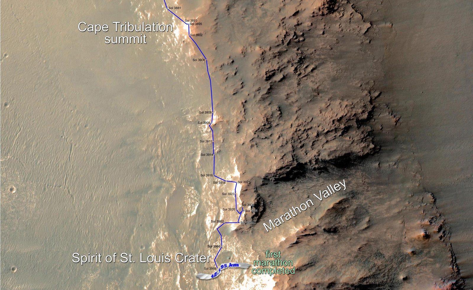
    A marathon without a finish line

    Opportunity passes 42.195 kilometres of cumulative driving on 24 March 2015

  5. 05

    When daylight disappeared

    Opportunity’s final contact during the June 2018 dust storm

The real parts, the equipment left behind, and the archive

Camera mast

Pancam

Stereo and colour views gave the team a way to examine terrain. Images of the Sun also helped estimate dust opacity.

The last faint-Sun thumbnails were used to estimate tau. They are not the same file as the last image transmitted.

Read the source ↗

Robotic-arm instrument turret

Mössbauer spectrometer

Measured iron-bearing minerals close to a rock or soil target.

The Berry Bowl comparison identified hematite as the major iron-bearing mineral in the spheres.

Read the source ↗

Robotic arm

Microscopic Imager

Provided close-up views, like a geologist’s hand lens.

The appearance and arrangement of small features could be compared with composition measurements.

Read the source ↗

Robotic arm

APXS

Investigated elemental composition at selected targets.

Chemical measurements added evidence that a landscape photograph could not supply.

Read the source ↗

Robotic arm

Rock Abrasion Tool

Removed weathered material so the instruments could examine a fresher rock surface.

The tool’s cable-shield cuff included aluminium recovered from the World Trade Center site: a memorial carried with the science hardware.

Read the source ↗

Mast viewing system

Mini-TES

Studied thermal infrared light from the surrounding rocks and soil.

Remote observations helped the team choose places for closer investigation.

Read the source ↗

Rover deck and electronics

Solar arrays and onboard memory

Supplied electrical power and held observations until they could be returned.

Wind cleaning and changes to memory operations helped the long mission continue. RAM-only operation required returning data before power-down.

Read the source ↗

Different pieces, different resting places.

  • Challenger Memorial Station

    The landing platform remained in Eagle Crater. The site was named for the Challenger crew.

    Mission record ↗
  • Heat shield, backshell and parachute

    Arrival hardware stayed in Meridiani Planum. Opportunity later photographed discarded equipment near its landing area.

    Mission record ↗
  • The rover and attached instruments

    Opportunity’s final working location was Perseverance Valley. Contact ended, but its returned observations remain available on Earth.

    Mission record ↗

This reading room identifies documented places without claiming a new precision GIS survey. Coordinates and elevations in a technical dataset need their reference frame, observation and uncertainty—not just a long decimal.

Machine voices and diagrams are imagined, AI-assisted storytelling. Photographs and historical records are identified separately. NASA does not endorse RoverVilla.

Meet Oppy

Every part, up close

Turn it, pick a part to see what it did, pull the parts apart, or download it to print your own.

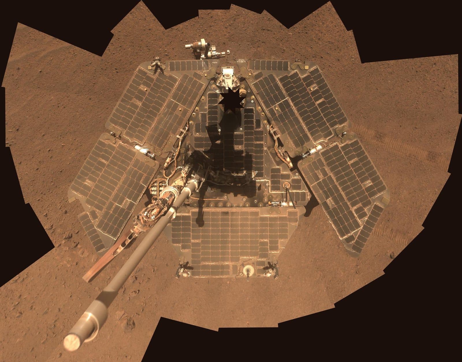
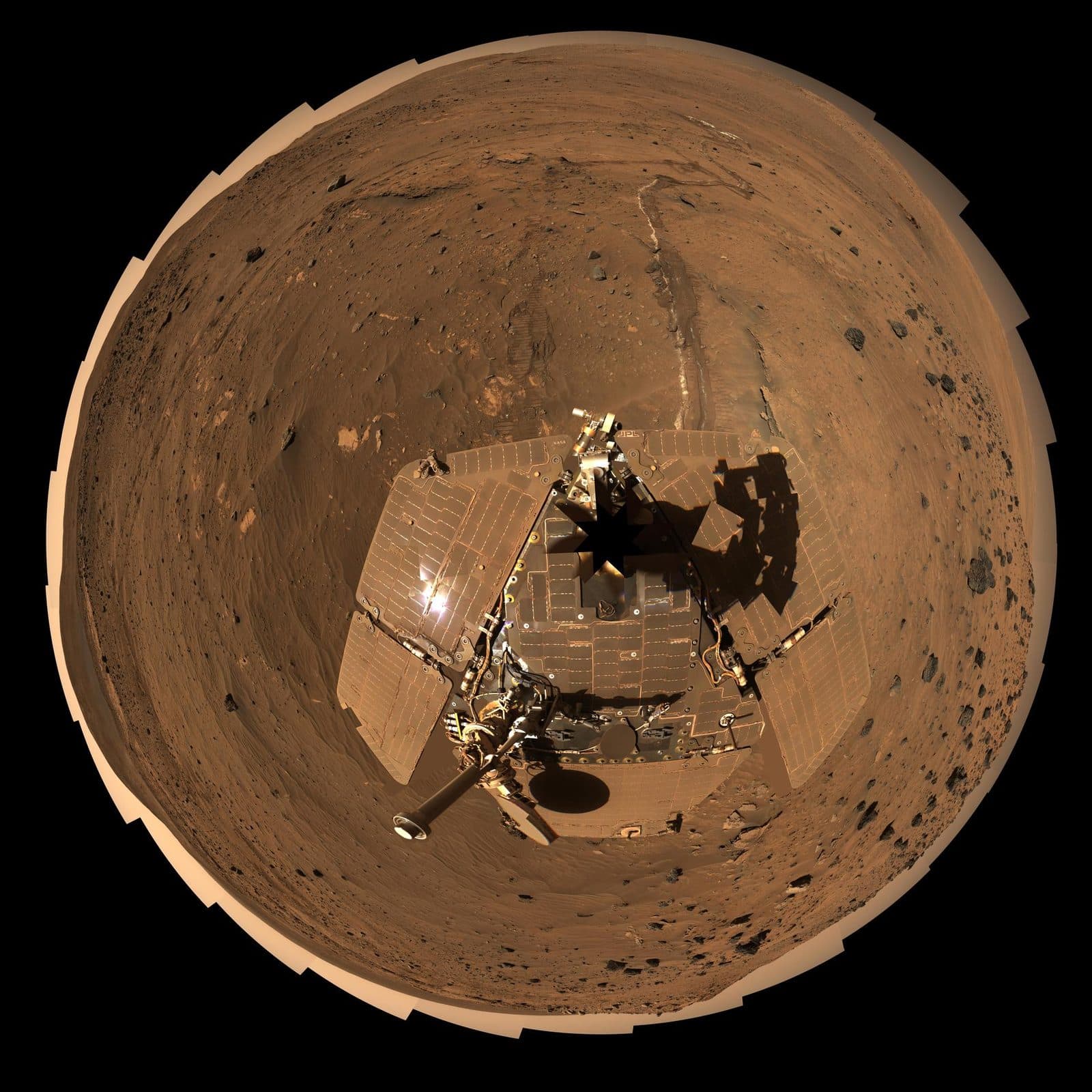
A self-portrait of NASA Mars Exploration Rover Opportunity taken by the rover panoramic camera Pancam in late March 2014 shows effects of recent winds removing much of the dust from the rover solar arrays.
Drag to turn · pinch or scroll to zoom

Parts

Download

Model: Mars Exploration Rover (MER-B), NASA 3D Resources. The STL is exported from it for printing; most printers will need supports.

The odometer

It was built to drive 1 km.

  • Planned1 km driven
  • May 2013: passes Apollo 17's lunar rover35.744 km driven
  • July 2014: past Lunokhod 2's 39 km40.25 km driven
  • 24 March 2015: exceeds marathon distance42.195 km driven
  • Final, when the mission ended45.16 km driven

Interactive Mission Simulation

MER Twins: Mars Exploration Rover Simulator

Traverse 45 kilometers across Meridiani Planum from Eagle to Endeavour Crater.

Play Simulation

Life’s work

They went where we couldn’t.

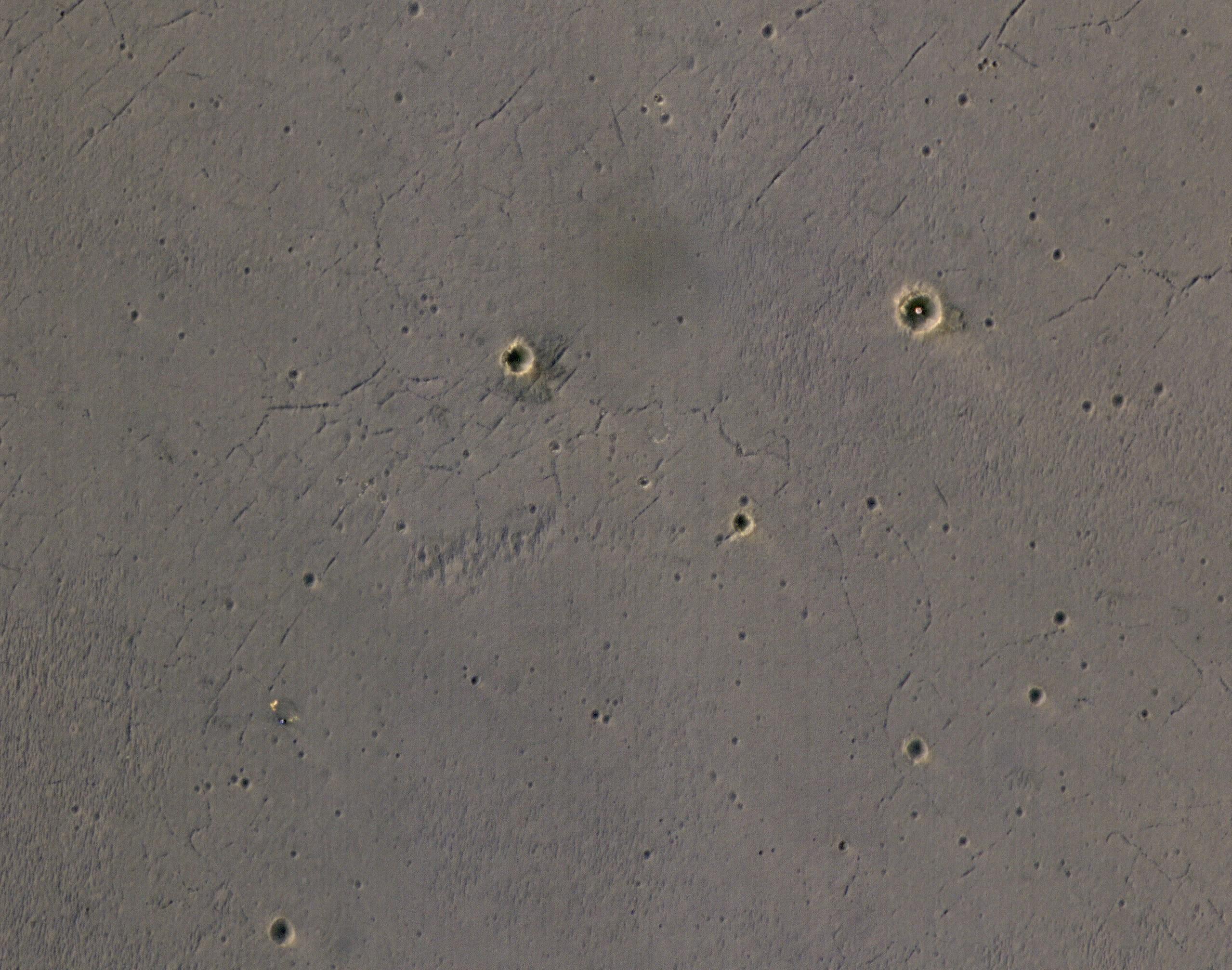
  1. The bright landing platform left behind by NASA's Mars Exploration Rover Opportunity in 2004 is visible inside Eagle Crater, at upper right in this April 8, 2017, observation by NASA's Mars Reconnaissance Orbiter.No. 01

    Eagle crater

    2004

    Rolled to a stop inside a small crater beside exposed bedrock. Its landing platform is still there.

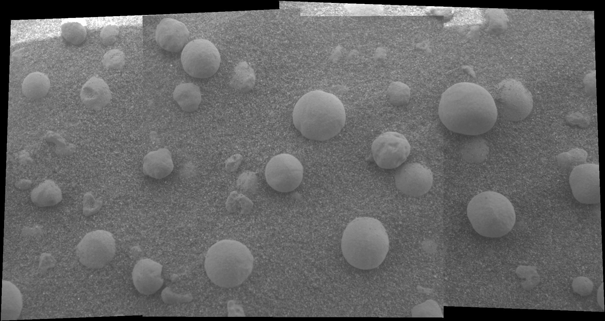
  2. This mosaic image shows an extreme close-up of round, blueberry-shaped formations in the martian soil near a part of the rock outcrop at Meridiani Planum called Stone Mountain.No. 02

    Blueberries

    2004

    Tiny hematite spheres and layered bedrock showed that liquid water once soaked these rocks.

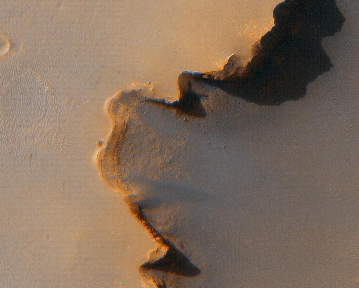
  3. The Opportunity Rover at Victoria CraterNo. 03

    Victoria crater

    2006–2008

    Spent two years exploring the rim and walls of a crater 750 m wide.

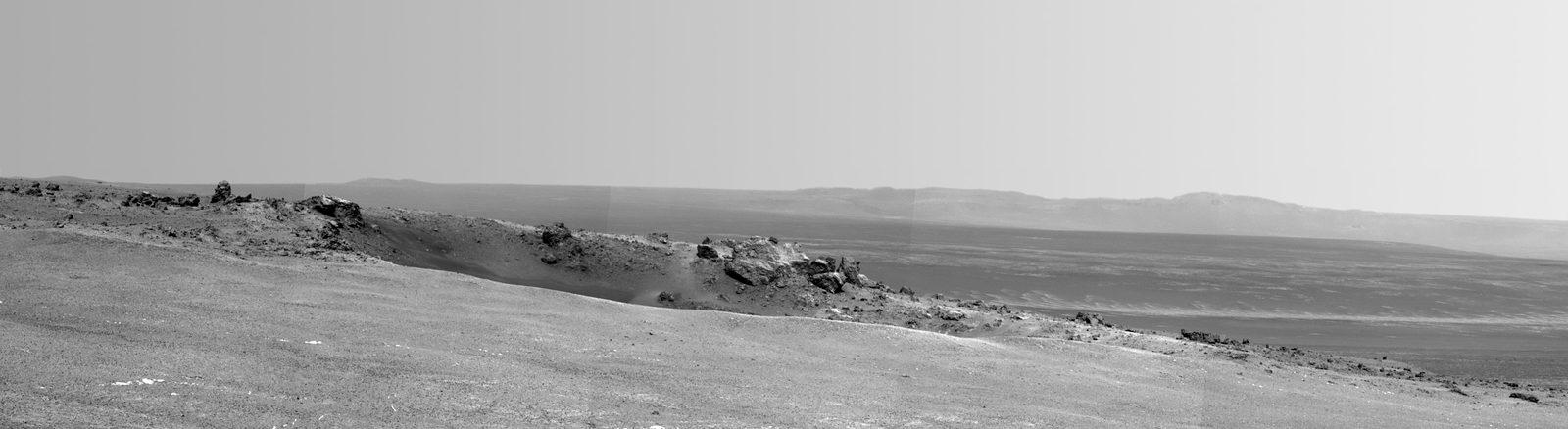
  4. This scene captured by NASA Mars Exploration Rover Opportunity shows the Spirit Point area of the rim, including a small crater, Odyssey on the rim, and the interior of Endeavour beyond.No. 04

    Endeavour crater

    2011

    Reached a crater 22 km wide and found a bright vein of gypsum.

  5. Eleven years and two months after its landing on Mars, the total driving distance of NASA's Mars Exploration Rover Opportunity surpassed the length of a marathon race: 26.219 miles (42.195 kilometers).No. 05

    Marathon

    2015

    Passed the length of a marathon, 42.2 km, in March 2015.

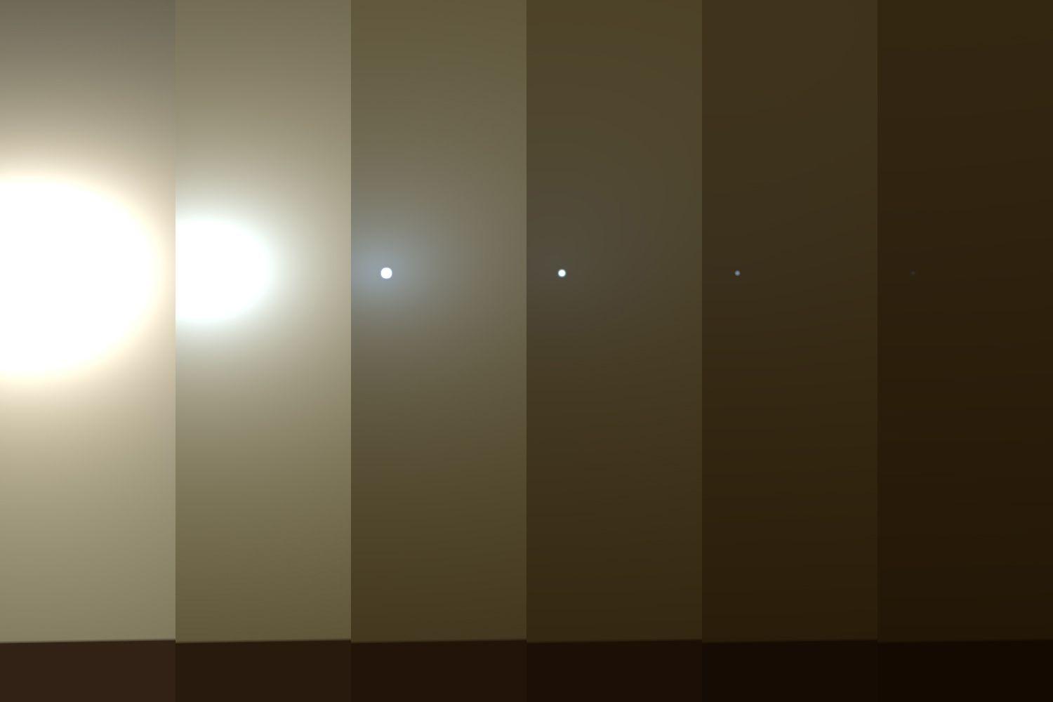
  6. This series of images shows simulated views of a darkening Martian sky blotting out the Sun from NASA's Opportunity rover's point of view, with the right side simulating Opportunity's current view in the global dust storNo. 06

    The storm

    2018

    A planet-wide dust storm cut off the sunlight it needed for power.

Born on Earth

Launch

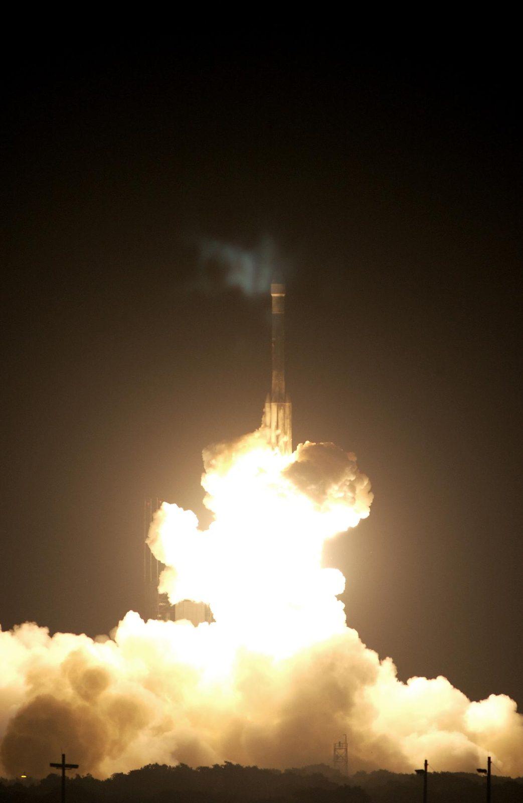
On Launch Complex 17-B, Cape Canaveral Air Force Station, the Delta II Heavy launch vehicle carrying the rover "Opportunity" for the second Mars Exploration Rover mission launches at 11:18:15 p.m.
Opportunity's Delta II Heavy lifts off, 7 July 2003 · NASA/KSC

7 July 2003 · 23:18 EDT
Delta II 7925H · Space Launch Complex 17B

Built by JPL.

Arrival on Mars

Landing

The bright landing platform left behind by NASA's Mars Exploration Rover Opportunity in 2004 is visible inside Eagle Crater, at upper right in this April 8, 2017, observation by NASA's Mars Reconnaissance Orbiter.
Rover Landing Hardware at Eagle Crater, Mars · NASA/JPL-Caltech/Univ. of Arizona

25 January 2004
Eagle crater · Airbag landing

Route

45.16 km

EagleEnduranceVictoriaEndeavour

Illustrative path, not to scale · Background: Victoria crater, NASA/JPL/University of Arizona

Dust blotted out the Sun

Last signal

10.06.2018

A planet-wide dust storm blotted out the Sun. Opportunity's final data, sent on 10 June 2018, showed very low power and a darkening sky. Engineers sent more than a thousand commands without a reply and declared the mission complete on 13 February 2019. The often-shared line "My battery is low and it's getting dark" is a journalist's paraphrase of that data, not a transmission.

Background: Shades of Martian Darkness · NASA/JPL-Caltech · Simulated darkness graphic, not a final camera frame

The full story

Opportunity, from start to finish

Opportunity was NASA’s MER-B Mars rover. Its short primary mission became a long geological investigation: cameras, instruments and wheels gathered evidence of ancient water across Meridiani Planum and Endeavour Crater. The rover’s final communication was received on 10 June 2018; mission completion was announced on 13 February 2019. The 2026 distance record handoff is a later event, not a signal from the retired rover.

A travelling geology laboratory

Pancam: Stereo and colour views gave the team a way to examine terrain. Images of the Sun also helped estimate dust opacity. The last faint-Sun thumbnails were used to estimate tau. They are not the same file as the last image transmitted.

Mössbauer spectrometer: Measured iron-bearing minerals close to a rock or soil target. The Berry Bowl comparison identified hematite as the major iron-bearing mineral in the spheres.

Microscopic Imager: Provided close-up views, like a geologist’s hand lens. The appearance and arrangement of small features could be compared with composition measurements.

APXS: Investigated elemental composition at selected targets. Chemical measurements added evidence that a landscape photograph could not supply.

Rock Abrasion Tool: Removed weathered material so the instruments could examine a fresher rock surface. The tool’s cable-shield cuff included aluminium recovered from the World Trade Center site: a memorial carried with the science hardware.

Mini-TES: Studied thermal infrared light from the surrounding rocks and soil. Remote observations helped the team choose places for closer investigation.

Solar arrays and onboard memory: Supplied electrical power and held observations until they could be returned. Wind cleaning and changes to memory operations helped the long mission continue. RAM-only operation required returning data before power-down.

Landing equipment and the machine that drove away

Four interconnected Vectran airbags had six lobes each: 24 lobes, not 24 separate bags. The landing equipment helped deliver a rover that could move away from its platform.

Challenger Memorial Station: The landing platform remained in Eagle Crater. The site was named for the Challenger crew.

Heat shield, backshell and parachute: Arrival hardware stayed in Meridiani Planum. Opportunity later photographed discarded equipment near its landing area.

The rover and attached instruments: Opportunity’s final working location was Perseverance Valley. Contact ended, but its returned observations remain available on Earth.

Evidence with its context intact

Hematite was identified as the major iron-bearing mineral in the Berry Bowl spherules. Their arrangement and rock setting supported a water-formed concretion interpretation; the mineral name alone does not prove how any rock formed.

Solar-array output and battery charge are different quantities. Optical depth is not a direct percentage of all sunlight on a panel. After contact ceased, possible internal faults were engineering inferences, not continuing telemetry.

PIA22521 is a simulated darkness graphic. The final faint-Sun thumbnails are PIA22930; the last incomplete image transmitted is PIA22929. An image taken last is not necessarily the image received last.

The trail outlasted the transmission

Opportunity accumulated 45.16 kilometres of driving. On 11 October 2026, Perseverance’s odometer reached 45.22 kilometres and passed that off-world record.

The rover’s observations continue to support research. The machine left behind, the returned data and a later rover’s record are different parts of the legacy.

Fly along

Follow Opportunity's real path in NASA's Eyes on the Solar System, built from spacecraft navigation data.

NASA/JPL-Caltech · open full screen

Watch

Official films and footage from NASA, JPL and museum archives.

In the news

Articles, image releases and history pieces from NASA.

Its twin

Spirit

No. 09 · 2004–2010

Visit Spirit

Tribute wall

Checking authentication…

Messages from explorers (0)

  • No messages yet. There’s room for your little thank-you.

The shared RoverVilla wall stays here on Earth. These messages are not transmitted to a spacecraft.

Explore further

Official mission pages, catalogues, photo archives and 3D files.

AI-narrated documentary

Opportunity: in its own words

Coming soonAI-made

Coming later

An AI-narrated documentary

We have not made it yet. When it is ready it will be told in the first person by an AI voice, built only from the mission records above, and clearly labelled as AI-made.

Sources

Resting on Mars. Photos are from NASA's public archives and credited individually; anything marked AI-generated is not a real photo. The 3D model is NASA's own. Videos play from their publishers' YouTube channels. NASA does not endorse this site.